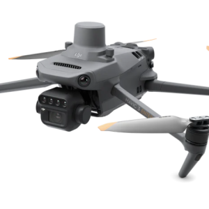
Compact and portable – Foldable for easy storage
MAVIC 3 Multispectral – KEY FEATURES
- Multispectral payload : Near Infrared, Red, Red Edge, Green
- 4 × 5MP Cameras (NIR, R,RE,G)
- RGB camera -20 MP (4/3 CMOS, mechanical shutter)
- RTK as standard
- Long battery life: 45 minutes maximum flying time
- Enhanced Flight Safety: Omnidirectional obstacle sensing and advanced Return to Home
- Controller: New DJI RC Pro Enterprise smart controller
- Accessories: Including RTK Module, Loud Speaker and 3rd party products, for example, search light.
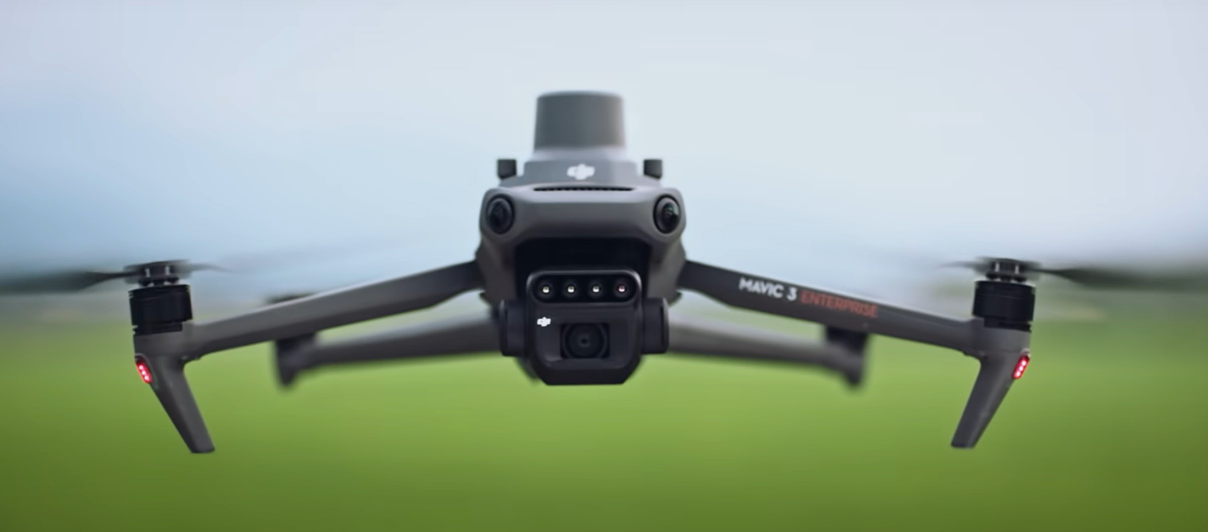
Effective aerial surveying needs to see the invisible. The Mavic 3 Multispectral has two forms of sight. It combines an RGB camera with a multispectral camera to scan and analyze crop growth with total clarity. Agricultural production management requires precision and data, and Mavic 3M delivers both.
Its built-in camera array combines Green, Red, Red Edge, and Near Infrared sensors:
- Near Infrared: 860 nm ± 26 nm
- Red: 650 nm ± 16 nm
- Red Edge: 730 nm ± 16 nm
- Green: 560nm ± 16 nm
Multispectral Camera
4 × 5MP
G/R/RE/NIR
RGB camera
20 MP
4/3 CMOS, mechanical shutter
Safe and stable
Omnidirectional Obstacle Avoidance
15km Transmission Distance (limited in EU and UK)
Precise positioning
Centimeter-level RTK positioning
Microsecond-level time synchronization
Efficient aerial surveying
Up to 200 hectares per flight
Highly integrated imaging system
Newly upgraded imaging system with one 20MP RGB camera and four 5MP multispectral cameras (green, red, red edge, and near infrared). Enables applications such as high-precision aerial surveying, crop growth monitoring, and natural resource surveys.
RTK Module Included
The Mavic 3M comes with an RTK module, allowing agricultural professionals to conduct highly precise aerial surveys without the need for Ground Control Points.
SOFTWARE
DJI SmartFarm app, allowing users to coordinate data gathered with spraying and spreading operations.
DJI Terra – you can easily and efficiently create maps and models of your targets.
*Please note that the DJI Smart Agricultural Platform will be supported in 2023.
Open Ecosystem
Cloud API
The Mavic 3M can be directly connected to any third-party cloud platform via Pilot 2’s built-in DJI Cloud API.
MSDK
The Mavic 3M supports Mobile SDK 5 (MSDK5) with a fully open-source production code sample. The MSDK5 makes it possible to develop a proprietary control app for UAV field patrol, smart surveying, and other scenarios, making it more user-friendly.
Enhanced Safety
Omnidirectional Obstacle Sensing
Mavic 3 helps you to enjoy collision-free flight so you can focus on getting the best shots possible. Multiple wide-angle vision sensors work seamlessly with a high-performance vision computing engine to sense obstacles in all directions precisely and plan a safe flight route that avoids them.
Don’t Just Fly. Enjoy.
APAS 5.0
Mavic 3 makes flight more fun than ever with recording that is no longer interrupted by obstacles along the way. When flying, Mavic 3 continually senses objects in all directions and bypasses them quickly and smoothly.
O3+ Transmission and Beyond
- 46 Minutes Extended Flight Time
- 15 km Video Transmission Range
- Surveying Area in a Single Flight (2 Square Kilometers)
- Extreme-Precision Positioning Technology